

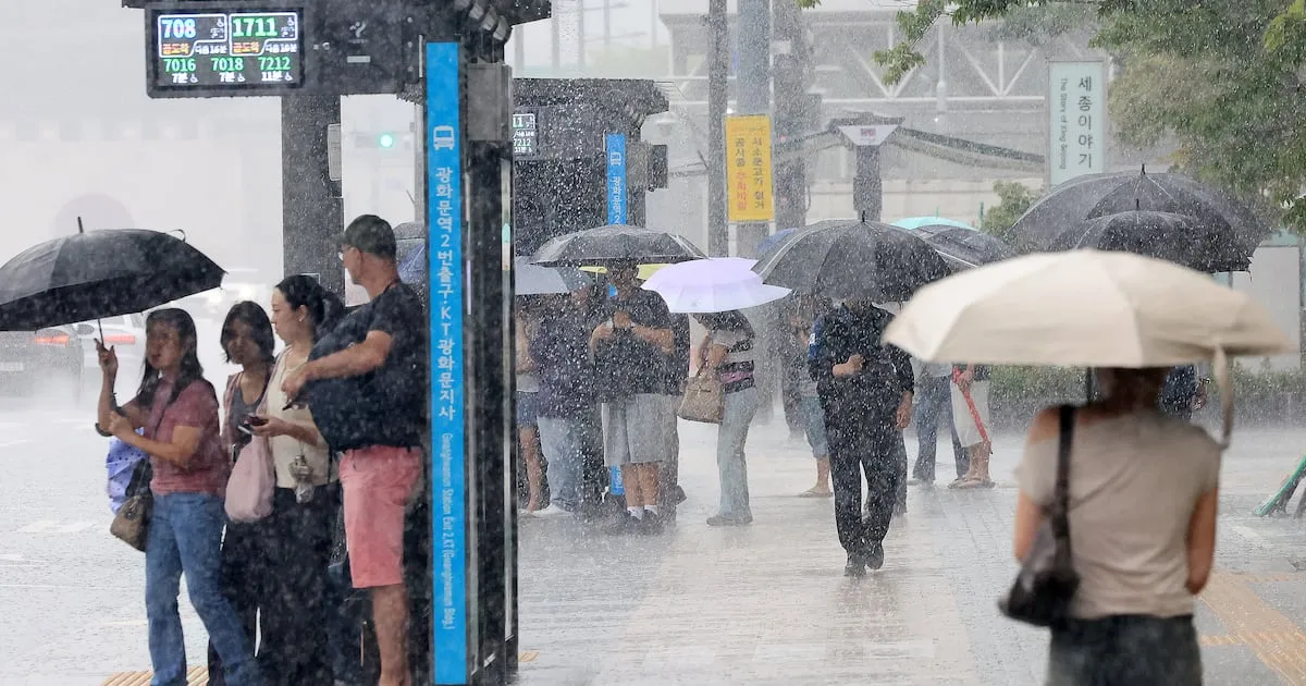
Central regions of South Korea, including the capital Seoul, are anticipating torrential downpours starting early Saturday morning, with rainfall rates potentially reaching up to 80 millimeters per hour. The Korea Meteorological Administration (KMA) has issued warnings for what is being described as “water bomb” level rainfall, urging residents to exercise extreme caution.
Intense Rainfall Forecast for Weekend
The KMA announced on Friday morning that a stationary front is expected to trigger the development of a deep low-pressure system. This system is predicted to bring very heavy and abundant rain, accompanied by strong winds, thunder, and lightning, particularly from early Saturday, June 18th, through Sunday, June 19th. The forecast indicates that the Seoul metropolitan area and Gangwon Province could receive between 100 to 200 millimeters of rain over the two-day period. Chungcheong Province is expected to see 80 to 150 millimeters.
The most intense rainfall is anticipated in the Seoul metropolitan area and parts of Gangwon and northern Chungcheong provinces, where accumulations could exceed 300 millimeters. Specifically, the Seoul metropolitan area is forecast to experience hourly rainfall rates of 50 to 80 millimeters from early Saturday morning into the afternoon. Southern regions will also see heavy rain from Saturday night into Sunday morning.
Understanding Extreme Rainfall Intensity
The KMA emphasized the severity of the predicted rainfall rates. Hourly precipitation exceeding 40 millimeters can make it difficult to open one’s eyes due to the sheer force of the rain. At rates above 50 millimeters per hour, visibility is severely reduced for drivers, and even walking becomes challenging. Rainfall reaching approximately 80 millimeters per hour carries the risk of widespread, large-scale disaster.
Historical data highlights the destructive potential of such intense rainfall. In 2011, Seoul experienced over 100 millimeters of rain per hour, which tragically led to landslides in the Umyeon Mountain area.
Flood and Landslide Warnings Issued
Given the forecast, the KMA indicated a possibility of urgent disaster warnings being issued for certain areas. The agency stressed the need for vigilance regarding landslides, soil erosion, and rockfalls, especially since the ground in many regions has been weakened by the monsoon season, which began on June 30th.
The influence of the stationary front is expected to persist even after Sunday. Rainfall is predicted across the country at various locations until June 20th, with widespread rain anticipated nationwide from June 23rd onwards.
Safety Precautions Advised
The KMA strongly advised the public to take necessary precautions to prevent potential damage and ensure safety:
- Avoid Water Activities: Due to the rapid rise in river levels caused by intense, short-duration rainfall, people should refrain from playing in or near streams and rivers.
- Steer Clear of Flooded Areas: Residents are urged not to enter submerged roads or underpasses, especially small culverts, which can become dangerous traps during heavy downpours.
- Monitor Warnings: Stay informed about weather alerts and disaster warnings issued by the KMA and local authorities.
- Prepare for Landslides: In mountainous or hilly areas, be aware of the increased risk of landslides and soil erosion.
The prolonged presence of the stationary front suggests that the heavy rainfall could continue intermittently for an extended period, making preparedness crucial for residents in affected areas.
Extended Monsoon Outlook
Looking beyond the immediate weekend forecast, the KMA anticipates that the stationary front will continue to influence weather patterns across the Korean Peninsula. Rainfall is expected in various parts of the country through June 20th. By June 23rd, a more widespread rain system is projected to cover the entire nation.
This extended period of precipitation, characterized by intense bursts, poses a significant risk of flash flooding and requires continuous monitoring and adherence to safety guidelines. The KMA reiterated its advice to avoid low-lying areas, flooded roads, and waterways, emphasizing that swift action can mitigate the impact of these severe weather events.
